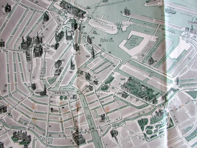
Amsterdam port official map c.1915-20 Vintage Europe City Plan harbor IJ river
Seller: oldmapsoldbooks ✉️ (11,966) 100%,
Location: Dover, New Hampshire, US,
Ships to: US & many other countries,
Item: 123342633580
Amsterdam port official map c.1915-20 Vintage Europe City Plan harbor IJ river.
Amsterdam port official map c.1915-20 Vintage Europe City Plan harbor IJ river
Amsterdam port official map c.1915-20 Vintage Europe City Plan harbor IJ river
|
- Condition: Detailed vintage early 20th-century European city plan. Paper and image remains clean and well preserved with a fine patina. Some minor splitting at fold line intersections or ends but overall well-preserved with a nice visual appeal. Original fold lines as issued in a folding pocket map format.
PicClick Insights - Amsterdam port official map c.1915-20 Vintage Europe City Plan harbor IJ river PicClick Exclusive
- Popularity - 5 watchers, 0.0 new watchers per day, 2,056 days for sale on eBay. Super high amount watching. 0 sold, 1 available.
- Best Price -
- Seller - 11,966+ items sold. 0% negative feedback. Great seller with very good positive feedback and over 50 ratings.
People Also Loved PicClick Exclusive

Amsterdam Netherlands 1835 S.d.u.k. Antique Original Steel Engraved City Map
£16.06 1 Bid 6d 14h
Amsterdam Holland detailed city plan 1910-20 Bartholomew small charming map
£38.55 Buy It Now 10d 9h
Amsterdam Holland c.1920's Vintage Europe City Plan cartoon style buildings
£80.32 Buy It Now 14d 2h
1835 Antique Map Amsterdam Netherlands Baldwin & Cradock
£16.06 Buy It Now 25d 8h
United Provinces Netherlands Holland Amsterdam 1821 Carey large historical map
£61.04 Buy It Now 27d 1h

